In Part 2, I describe the functionality in linkedplaces.draw to date. At some point, a collaboratively authored functional spec for a ‘proper’ crowd-sourcing tool will come together on GitHub.
I have been building a pilot tool for digitizing features from georeferenced historical maps (and maps of history such as found in historical atlases), tentatively named linkedplaces.draw. Its immediate intended use is for what we at the University of Pittsburgh World History Center have been calling “historical mapathons.” We are planning to facilitate, stage and encourage such events, in which individuals and small groups can virtually gather to harvest temporally scoped features from old maps, for their immediate use and for preparing contributions to World Historical Gazetteer (WHG) [1]. We have begun testing it by digitizing features for settlements, archaeological sites, regions, dynasties, and ethnic groups from the highly regarded “An Historical Atlas of Central Asia” (Bregel 2005).

Maps v. Texts as Gazetteer Sources
Old maps represent a largely untapped storehouse of information about geographies of the past. Digitizing features from maps that can be geo-referenced (a.k.a. geo-rectified, or warped) without too much distortion provides an estimated geometry that is invaluable. The most immediate use scenario driving development of WHG is mapping place references in historical texts and tabular datasets. But to make a digital map you need geometry, however approximate. Discovering suitable coordinates for lists of place names drawn from historical texts is far and away the most difficult and time-consuming task in this scenario. If your source texts are of a region and period it makes sense to build a gazetteer of that region and period using maps made at the time–and then to contribute the data to WHG so no one has to ever do it again! Certainly, the feasibility of deriving useful geometry in this way is reduced the further back in history one goes.
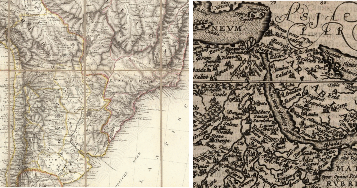
Maps made prior to the 18th century–beautiful, instructive, and useful as they may be–normally don’t have sufficient geodetic accuracy for this purpose (Fig. 2b). Obtaining geometry for place references made in earlier periods will require a different approach, e.g. capturing topological relations like containment. Also, one can also digitize features from maps of history, as we are doing with the Bregel atlas mentioned above.
The GB1900 Proof-of-Concept
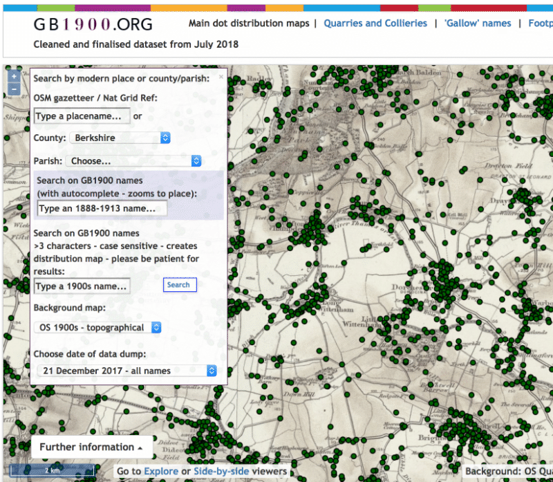
Although hundreds of thousands of old maps have been scanned and made available for viewing and download by map libraries around the world [2], the names and estimated coordinates of features on them have not been transcribed in any quantity. The recent project GB1900 provided a successful proof-of-concept (cf. “The GB1900 project–from the horse’s mouth“). Crowd-sourcing map transcription software was custom built for the public at large to work with a single Ordnance Survey map, and over a period of months millions of names and geometries were digitized. Preliminary results can be viewed at http://geo.nls.uk/maps/gb1900/; analytical products are sure to follow. Unfortunately the software used for GB1900 cannot be re-purposed for other maps and general use.
Unfortunately, although the code for the GB1900 crowd-sourcing software is available, it is not re-usable; at least I and others have been unable to revive it. Hence, linkedplaces.draw, which will hopefully serve as a demonstrator that could be used in finding funds to build a sturdy open-source platform that can be used by groups of any size–including “the crowd”–to do this valuable work.
Related Tasks and Software
Several existing free software packages and web sites provide users the capability to perform these tasks related to old map feature digitization, in some combination: a) georeference a map image and save the rectified result as a GeoTIFF, b) create web map tilesets from a GeoTIFF file, and c) display single images or tilesets as overlays on modern web base maps. Typically viewers for these provide an opacity control, allowing comparison of old and modern geography. This is all great, but what is missing is the capability to draw or trace features from the rectified images.
Coda (for the moment)
For years, computer scientists and others have explored the possibility of automated feature extraction. There are a few such efforts under way right now. I wish them godspeed, and do believe machine methods will ultimately be able to extract a list of names from some relatively recent map series having especially clear cartography, but also that they will never handle maps like Figure 2a, and will never successfully extract the estimated geometry of even point features. Yes I know, never say never. In the meantime…
[1] The World Historical Gazetteer project is building a web platform for developing, publishing, and aggregating data about places drawn from historical sources by members of the broad community of interest studying the past within and across numerous disciplines. A Version 1 launch is planned for June/July 2020. See the About pages and Tutorials as http://dev.whgazetteer.org for details.
[2] The extraordinary David Rumsey Map Collection has many extended features and direct hi-res downloads; Old Maps Online is a “gateway to historical maps in libraries around the world.”