PhD Dissertation – Representing Historical Knowledge in Geographic Information Systems
Screenshots
Organization
University of California, Santa Barbara — Department of Geography
Roles
Doctoral Researcher; Concept and Data Modeler; System Architect
Technologies
First-order logic; Protégé; PostgreSQL + PostGIS; QGIS; ontology engineering methods
Description
My dissertation, Representing Historical Knowledge in Geographic Information Systems, addressed a perceived conceptual problem facing digital historical scholarship in the 21st century: how to move beyond static print historical atlases toward geo-historical information systems capable of modeling dynamic human activity across space and time. The research asked three questions: (i) What may digital historical atlases be? (ii) What are their representational requirements? and (iii) What extensions to traditional GIS data models are necessary to meet those requirements?
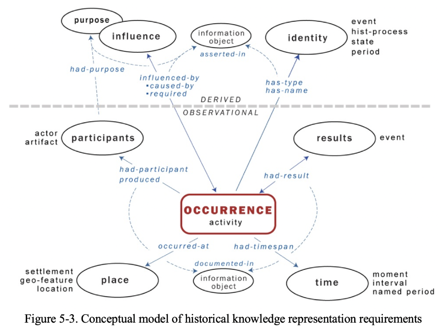
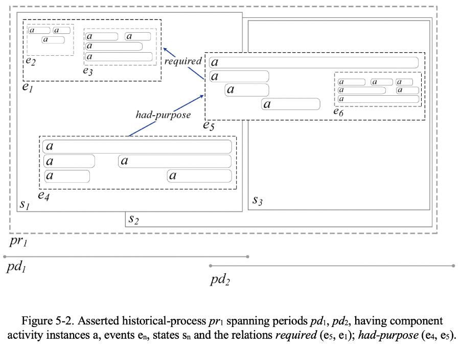
The work proceeded from the premise that historical knowledge requires representational structures capable of representing events, processes, change, simultaneity, uncertainty, and multiple interpretive voices. Using ontology engineering as the primary methodological framework, I enumerated a set of representational requirements for an emerging genre of digital historical atlas and formulated competency questions to evaluate candidate models.
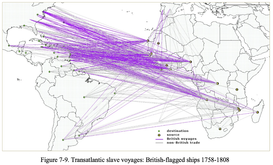
One outcome was a Spatial History Ontology (SHO), an ontological extension of the DOLCE top-level ontology, designed to support formal expression of historical entities, relations, and processes within geographic computing environments. SHO was implemented in Protégé and realized in a prototype object-relational spatial database (PostgreSQL + PostGIS) populated with six diverse exemplar datasets. This prototype demonstrated how ontology-informed modeling can enable new forms of historical representation and analysis beyond the capabilities of conventional GIS or print atlases.
The dissertation contributed both a conceptual framework and an implemented model for representing historical knowledge in geographic information systems, broadly speaking, and laid groundwork for my later work on Linked Places Format (LPF), the World Historical Gazetteer, and other digital humanities works and infrastructures built around spatial-temporal knowledge representation.